 you are not logged in


![]()
![]()
![]()
 SMOS Lead Investigator: interview with Yann Kerr - a need for a SMOS-like instrument with a spatial resolution adapted to water resource management
Yann Kerr was one of the scientists that proposed the mission. As Lead Investigator for soil moisture, his role has been to maintain the scientific integrity of the mission as it went from a paper design to a real satellite.
ESA: What was your role in the SMOS project?
Yann Kerr:
After identifying the need for soil moisture measurements from my work
in Africa’s Sahel region, I tried all possible venues with satellites
and came to the conclusion (in the late 1980s) that only passive
microwaves at L-band could provide the means of obtaining these
measurements. The problem then shifted to finding out how we could put
a suitable L-band antenna in space.
After a stay in the US at NASA’s Jet Propulsion Laboratory, I started
looking at what they were investigating then –1D interferometry – as
the most promising solution to the antenna-size dilemma. Once back in
France with radio astronomers, we found the 2D solution. It was a long
path from the inception in the late 1980s to the approval by CNES in
1998 and the subsequent selection by ESA in 1999 for a launch in 2009 –
almost two decades!
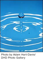
ESA: What is soil moisture?
Yann Kerr:
Soil moisture is both a complex and simple concept. Simple because
everybody understands the difference between a wet and dry soil but
complex as it may refer to many different things. For instance, for
heat and mass transfer between the surface and the atmosphere (what
actually drives the weather), the water in the first centimetres is the
most important. For vegetation, it is the water in the first metre or
so where it is pumped by roots, and for a city it might be water in the
water table sometimes several 100 m below the surface.
SMOS will directly measure the water available in the first centimetres
of the soil. It will also deliver the amount of water available in the
root zone area i.e., the area where vegetation also pumps the water
after some processing.
ESA: Why is it important to measure and map soil moisture?
Yann Kerr:
Simply because water is the basis of life. It impacts our life through
a multitude of effects. The main effect is on vegetation growth; hence
knowing soil moisture will eventually be key to better water resource
management. This information also has a direct impact on the
availability of drinking water.
Water stored in the soil drives the exchange of heat and mass to the
atmosphere, and thus is key for improving weather forecasts and the
huge economic impact that accompanies some weather conditions. It has
also been proven that better knowledge of soil moisture is crucial for
being better able to predict extreme events, particularly very strong
rainfall and floods. Floods are not only linked to large rainfalls, but
also to run off, so a little bit of rain on saturated soil may have a
dramatic influence while a heavy rain on dry soil could induce no run
off.
ESA: What are the challenges of measuring soil moisture?
Yann Kerr:
To be efficient and representative, soil moisture must be measured over
a significant depth (at least 3-4 cm). It must also be measured
frequently (memory of soils) and at least every three to five days.
Ideally the spatial resolution should be of the dimension of the spatial variability. The measurement should be able to penetrate through vegetation. Perhaps most importantly, it must be a quantitative measurement not a relative one. These requirements lead to a system with all-weather capability, a good revisit frequency and a large probing depth – in other words, an L-band radiometer.
Once the system is selected, the remaining challenges, apart from the spatial resolution, are the algorithms that take into account the vegetation contribution (and there, with its angular signature measurements, SMOS has a very efficient approach). We do nevertheless also fear the radio frequency interferences (RFI). Even though SMOS will operate in a protected band, RFI will be a challenge as many do not respect this band protection rule.
Finally as SMOS will be the first mission to measure soil moisture and
sea salinity globally from space with an instrument that has never been
flown before, we do expect to find a few unexpected features in store.
For the moment, we can also say that as it is a first and as we have no
elements, algorithms are very theoretically based and we cannot fully
ascertain them. As with all missions of this type, validation will also
be challenging.
ESA: Who are potential users of soil moisture data?
Yann Kerr:
The most interested users are obviously the science community and the
meteorological centres. Water management bodies will have a keen eye on
the first results and be quite ready to join the main users as soon as
the proof of concept is demonstrated. Similarly, decision makers and
risk assessment evaluators are also starting to investigate what the
potential uses could be.
ESA: Where will you be for launch?
Yann Kerr:
It was very tempting to be on the launch pad as it is going to be a
pretty exciting and stressful event! However, I finally preferred to be
in Toulouse, France, in the SMOS Control Room. There, I will be able to
follow all the key events minute-by-minute from launch, separation,
acquisition, deployment of solar panels and of the instrument, etc.
ESA: Are there any plans for a follow on to SMOS?
Yann Kerr:
Yes, of course, we have started thinking about the future already. We
have, with ESA, started considering and promoting the idea of a SMOS
follow on. Basically, the follow on would be the same mission and
satellite but with an operational setup. Potential key partners might
include the European Organisation for the Exploitation of
Meteorological Satellites (EUMETSAT) and the European Centre for
Medium-Range Weather Forecasts (ECMWF).
Perhaps more to the point, we have also identified a need for a SMOS-like instrument with a spatial resolution adapted to water resource management at a finer scale or an improved sensitivity for sea surface salinity. We finally found the solution with a concept able to fulfil these needs. This mission will be called SMOSNEXT, and I hope it will be launched in less than 20 years!
--
See the interview video at youtube
| Contact information | n/a |
|---|---|
| News type | Inbrief |
| File link |
http://www.esa.int/SPECIALS/smos/SEM2ELYRA0G_0_iv.html |
| Source of information | ESA |
| Keyword(s) | SMOS |
| Subject(s) | ANALYSIS AND TESTS , INFORMATION - COMPUTER SCIENCES , MEASUREMENTS AND INSTRUMENTATION , METHTODOLOGY - STATISTICS - DECISION AID , POLICY-WATER POLICY AND WATER MANAGEMENT , TOOL TERMS |
| Relation | http://www.semide.net/topics/fol573816 |
| Geographical coverage | Europe, France |
| News date | 19/10/2009 |
| Working language(s) | ENGLISH |
